This year we have focused on The Geology and Scenery of the Berwyn Mountains, North Wales.
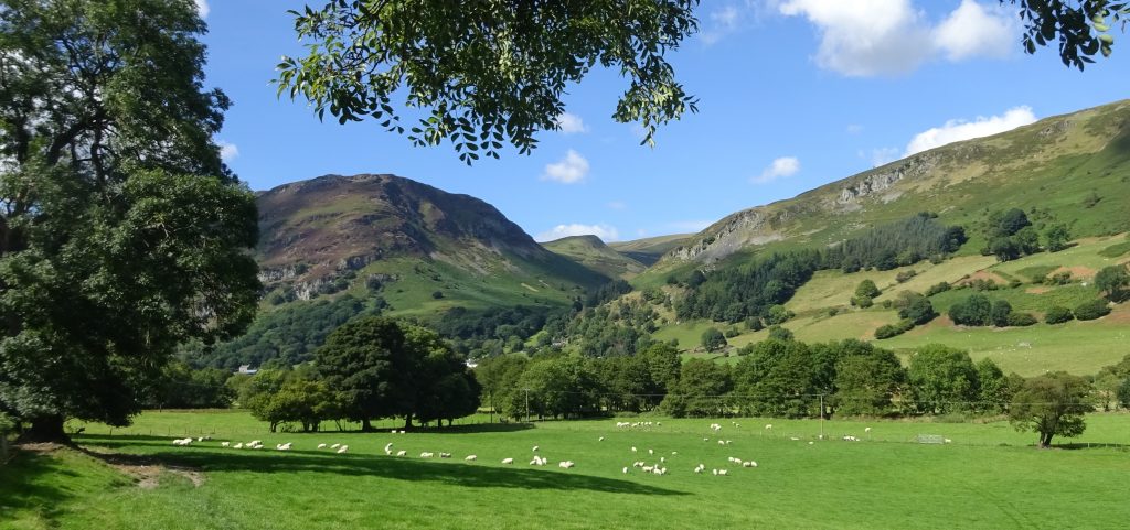
Photo 1 (above). Craig Rhiwarth mountain, left background, and the slopes of Glan Hafon, right background, rise steeply above the green fields of the Tanat Valley, in the southern Berwyn Mountains. In the centre background, between these two hills, lie the equally steep slopes of the Cwm Glan-hafon valley, which lead upwards to the distant summits of the main Berwyn Mountains in the far distance.
It is the geology and landscape of this beautiful part of northern Wales that we explore in this year’s Geoscience Wales Calendar.
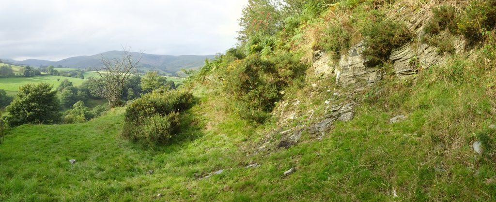
The central peaks of the Berwyn Mountains (background left in Photo 2, above) rise above the lush green valley of the Afon Iwrch, which drains south-eastwards from the main crest of the range towards the village of Llanrhaeadr-ym-Mochnant. The sunlit outcrops of thinly bedded shales in the right-hand foreground are part of a thick sequence of mainly mudstone dominated sediments (the Llangynog Formation) laid down across this part of North Wales during the Caradoc stage of the Ordovician period, around 450 million years ago. However, as we shall see in this year’s Geoscience Wales Calendar, not all of the sediments deposited in this part of Wales at that time were mudstones, and not all of the rocks which formed were sedimentary either. As in the adjacent regions of Snowdonia to the north and west of the Berwyn Mountains, coarser grained sandy sediments were also deposited in this part of Wales, and the area was tectonically active, with volcanoes erupting lava and ash into the atmosphere, and into the sea, whilst beneath the surface they were forcing spectacular intrusive igneous bodies to penetrate into and through the overlying rocks and sediments. It is this fascinating story of volcanoes and sedimentation, and also much later tectonic events, which forms the theme of this year’s Geoscience Wales Calendar. However, as space is necessarily limited here, further, more detailed information on the geology of the Berwyn Mountains, along with explanatory maps and diagrams, can be found on the Geoscience Wales website, at: www.geoscience-wales.co.uk (continued below)
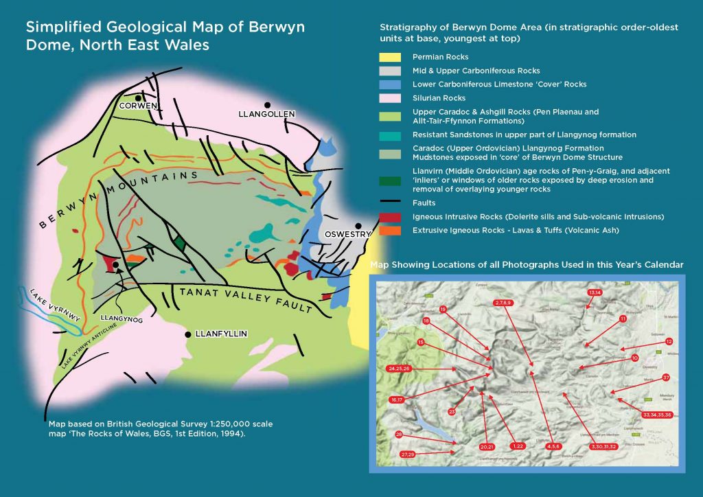
The Berwyn Mountains are another relatively little known region of north-east Wales (see map at the end of this introduction for their location, and for the locations of all photos used in this year’s calendar) that lies just to the south of the Clwydian Range and Denbigh Moors areas, which we explored in last year’s 2016 Geoscience Wales Calendar. These mountains lie between the towns of Bala, in central North Wales, to the west, and the town of Oswestry, at the edge of the Cheshire Plain, in the east. Although they rise to over 830m (2712ft) above sea level, and are therefore the highest mountains in north-eastern Wales, they are located in a relatively remote part of the Welsh Borderlands, away from the main transport routes of the Cheshire Plain to the east, and from the tourist hotspots of the North Wales coast and Vale of Llangollen, which lie to the north. However, to the traveller or tourist with a keen eye to explore new areas, a little off the beaten track, they represent an area of outstanding scenic beauty, with high rocky summit ridges, wild moorlands, deep cut craggy gorges and picturesque rural villages nestled in mysterious and remote hidden valleys; in addition, they also display some fascinating geology. Geologically, the Berwyn Mountains can also be relatively clearly defined, and the area is often known as the ‘Berwyn Dome’, but what shape is this dome, how was it formed, and what is its structure like in greater detail?
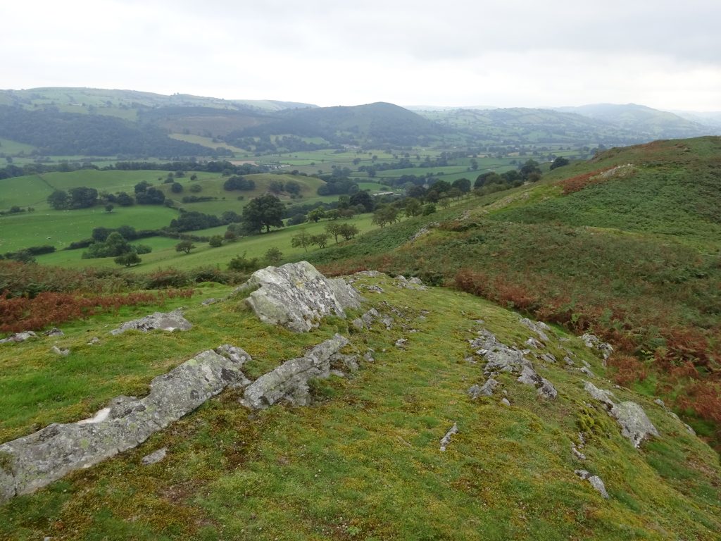
Photo 3 (above). The bracken clad ridges of Craig Orllwyn rocks, in the foreground, in the southern Berwyn Mountains, with the long west-east trench of the Tanat Valley in the middle distance to their left, and the green foothills of the main Berwyn Range in the far distance to their right. It is the hidden gems of rocky peaks, verdant green valleys, waterfalls and picturesque rural villages which make this area such a fascinating and rewarding place to explore. To help the reader understand the geology of the Berwyn Mountains better a simplified geological map of the area, with a key to the rock formations discussed in this year’s calendar is also included below